Residential Neighborhood Planning: From Site to Community

A neighborhood takes shape before its first home is designed. Residential neighborhood planning connects land, streets, shared spaces, and daily needs to give a community coherence. It also helps distinguish decisions about the overall layout from the design of individual homes and the rules that govern land use.
Those decisions are practical: where streets connect, how homes relate to public spaces, and how the site’s character informs the layout. This article explains what residential neighborhood planning addresses and how site conditions, movement, and shared spaces work together. Mark Tanney’s background includes Traditional Neighborhood Development and work in Florida’s Panhandle, including projects like Tapestry Park, Seaside, and Rosemary Beach. That regional experience offers a useful perspective without reducing neighborhood planning to a single style.
Key Takeaways
Residential neighborhood planning coordinates relationships across a community, beyond the design of any one home.
Street connections, pedestrian routes, and destinations influence how people move through a neighborhood.
Shared open spaces and transitions between public and private areas contribute to a place’s character.
A thoughtful plan starts with the site, then establishes priorities and connections before refining the layout.
Table of Contents
What Residential Neighborhood Planning Shapes Beyond a Street Layout
Residential neighborhood planning coordinates how homes, streets, open spaces, and shared destinations relate across a community. It establishes a framework for the whole neighborhood rather than focusing on one home. A home’s location matters, as do its connection to the street, the shape of the surrounding blocks, and its relationship to public spaces.
A neighborhood plan is a shared spatial framework, not a collection of disconnected building designs. It helps individual decisions contribute to a legible whole. A home can be designed beautifully on its own; planning considers how it meets the street, how people move through the area, and where public and private spaces meet. The Neighborhood planning overview provides broader context for the discipline and its development.
How a neighborhood plan differs from zoning and individual home design
Planning addresses spatial relationships: where streets and blocks connect, where homes sit, and how shared spaces fit into the pattern. Zoning is a separate regulatory layer that may govern land use and development standards. A plan can guide the arrangement of places, but it does not replace applicable regulations or determine what local rules permit.
Individual home design works at a more detailed scale, shaping a specific building within the larger pattern. For example, a home’s placement and orientation affect how it addresses the street, while the block pattern determines how that street connects to other parts of the neighborhood. These scales work together, but they answer different questions.
For a project in the Panama City Beach area, including 30A, applicable planning, zoning, and building requirements depend on the relevant jurisdiction. Verify current requirements through authoritative local sources. Keeping the regulatory layer distinct from the design framework helps clarify what the plan is intended to shape and what must be assessed separately.
How Streets, Homes, and Shared Spaces Create a Coherent Neighborhood
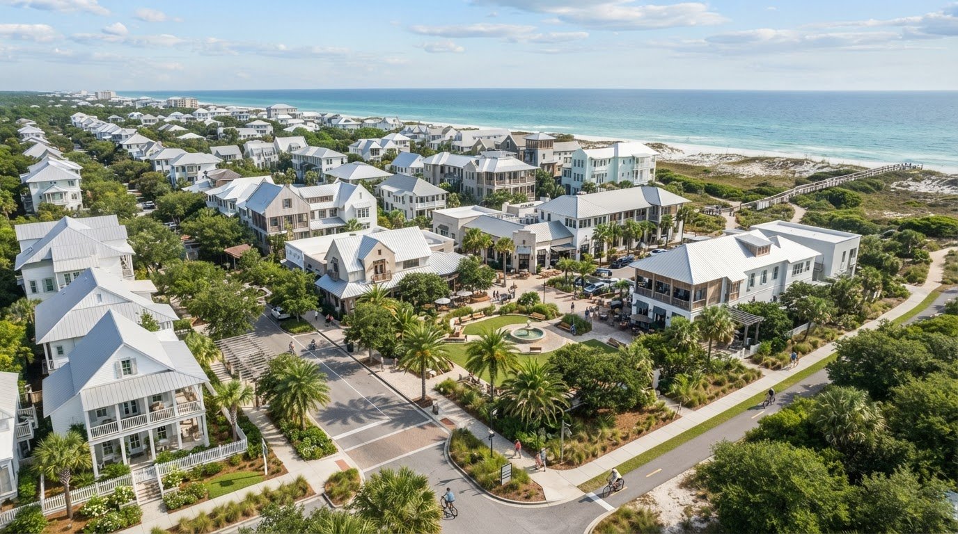
A street network shapes more than access. Its connections and block pattern influence which routes feel direct, where people encounter shared destinations, and how different parts of a neighborhood relate. Pedestrian paths can connect homes to open spaces or gathering places. The location of those destinations can also determine whether they sit along everyday routes or apart from them.
Housing and open space need to be considered together. Homes can define a street edge or frame a shared space. A front yard or a path between a home and a common green helps establish where private life meets public activity. A coherent plan coordinates connected elements rather than treating each decision in isolation.
What to consider when responding to a site's character
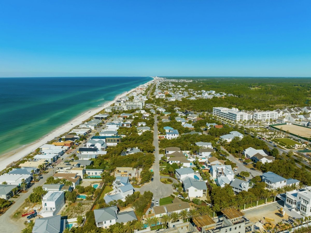
Start by observing the site and its surroundings: its shape, existing patterns, nearby streets and destinations, and connections to the surrounding area. Then identify what the community is meant to support. These observations can help determine where connections should continue, where shared spaces might fit, and how homes can relate to the larger setting. The aim is not to impose a template, but to shape a pattern that responds to the place and its purpose.
Florida Panhandle communities such as Seaside, Alys Beach, and Rosemary Beach offer regional context for considering neighborhood form, but each site calls for its own assessment. Mark Tanney’s work in the region, including experience under Town Architect Tom Christ, informs a perspective shaped by local context. For related residential design considerations, custom home design offers another perspective. TanneyDesign provides neighborhood planning that addresses relationships at the community scale.

From Site Context to a Residential Neighborhood Plan
A clear sequence can turn observations about a site into an organized framework. Begin with context, then set priorities, consider connections, and refine the layout. This approach gives project teams a practical way to evaluate how the parts of a neighborhood fit together.
Understand the site. Consider its shape, existing conditions, surrounding development, and connections to nearby streets and destinations. These details help reveal opportunities and constraints.
Establish priorities. Identify what the neighborhood should support, such as convenient movement, shared outdoor space, or a clear relationship between homes and public areas.
Organize connections. Consider how streets, pedestrian routes, blocks, and shared destinations could relate to one another and connect with the surrounding area.
Refine the layout. Review how the elements work together. Adjust the arrangement so homes, routes, and shared spaces support the priorities established for the plan.
Sound planning comes from informed decisions about place, movement, and community structure. Using these steps to review the layout can help keep design decisions connected to the priorities set for the neighborhood.
Regional experience that informs neighborhood planning
Mark Tanney has worked in Florida’s Panhandle, including Seaside and Rosemary Beach under Seaside Town Architect Tom Christ. His experience includes planning and designing the Traditional Neighborhood of Tapestry Park in Panama City Beach, Florida. These areas of experience inform a perspective on neighborhood form, from arranging places to coordinating the practical decisions that make a plan legible.
TanneyDesign provides neighborhood planning for community scale design. Explore the firm’s neighborhood planning work.
Shape the Next Step Around the Place
Before drawing a layout, define what the community should make possible. Consider which connections matter, how shared spaces could support daily routines, and which qualities should carry through the neighborhood as it takes shape. These priorities give residential neighborhood planning a clear point of reference as decisions develop.
For a project in Panama City Beach and the 30A area, start with the specific site and the people it is intended to serve. A strong plan responds to those conditions rather than relying on a borrowed template. Mark Tanney’s background in Traditional Neighborhood Development, space planning, and project management informs TanneyDesign’s neighborhood planning work.
Explore TanneyDesign’s neighborhood planning work to discuss how a thoughtful framework can help your community take shape. Each site offers a distinct opportunity to create a place with purpose.
Frequently Asked Questions
Is residential neighborhood planning the same as zoning?
No. Residential neighborhood planning and zoning are related but serve different purposes. A plan might consider whether an access point or open space supports the intended layout; zoning establishes regulatory parameters under applicable local rules. Treat these as complementary considerations and verify current requirements with the relevant jurisdiction before relying on a design assumption.
Can an existing neighborhood benefit from neighborhood planning?
Yes. Planning can help an existing neighborhood assess how infill, changing destinations, or evolving community needs might affect day to day function. Before adding homes on an underused parcel, for example, consider how access and shared outdoor areas relate to the wider area. This gives residents and decision makers a clearer basis for discussing priorities before individual design choices are settled.
What is the difference between neighborhood planning and urban planning?
Urban planning typically considers a broader municipal or regional picture, while neighborhood planning focuses on a smaller community area within it. Citywide decisions about growth or transportation can shape a neighborhood’s context; neighborhood planning considers how that context meets local patterns and priorities. Across Panama City Beach, Inlet Beach, Santa Rosa Beach, Grayton Beach, Destin, and Panama City, the appropriate scale depends on the project.
Comments